"https://www.bandg.com/assets/img/default-product-img.png?w=400&h=225&scale=both&mode=max"
B&G Zeus³ 7 kaartplotter met wereldbasiskaart
SKU: 000-13245-001
000-13245-001
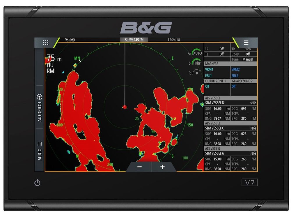
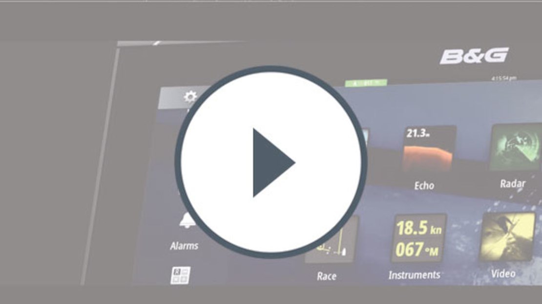
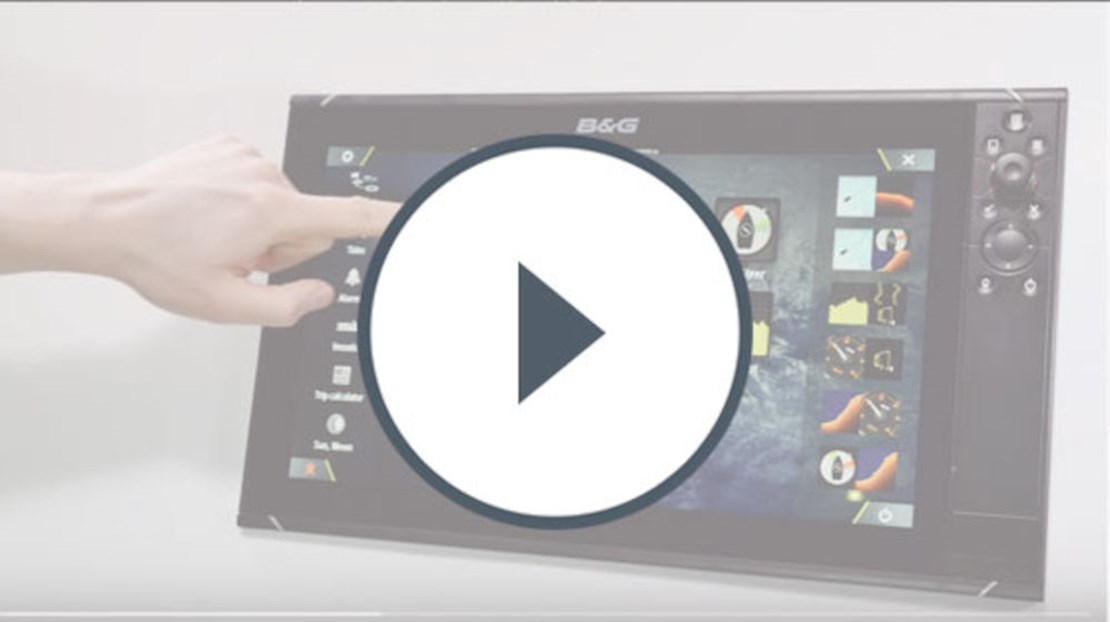
De Zeus³ 7 is een aanvulling op de grotere schermformaten van de Zeus3S-serie met een kleinere display voor jachten met beperkte installatieruimte. Dit superheldere scherm met brede kijkhoek, voorzien van een 7-inch touchscreen voor alle weersomstandigheden en draaiknop- en toetsenpaneelbediening, biedt onder alle omstandigheden optimale controle. Speciale, bewezen racefuncties, zoals SailSteer, Laylines en RacePanel, bieden optimaal gebruiksgemak. Het systeem heeft ingebouwde WiFi om verbinding te maken met online services en mobiele apparaten en is naadloos te integreren met een groot aantal verschillende instrumenten en accessoires die veiligheid, prestaties en comfort op het water optimaliseren.
BESPAAR €200
Speciale zeilfuncties voor cruisers en wedstrijdboten.
Navigeer vol vertrouwen met de bekroonde zeilfuncties van Zeus3:

SailSteer
Bekijk alle gegevens die u nodig hebt in één oogopslag op één gemakkelijk afleesbaar display met SailSteer. Bekijk cruciale informatie over wind, snelheid, getijden, richting, koers over de grond, layline en waypoint op één scherm, zodat u altijd over de informatie beschikt die u nodig hebt.
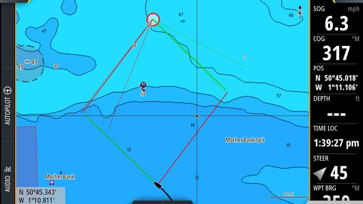
Laylines
Laat Zeus3 het zware werk doen: Bekijk uw koers en minimaliseer uw tijd die u kwijt bent met gelaagde laylines op uw kaart. Kijk welke manier het beste is en zorg ervoor dat u op de juiste plek blijft om zo efficiënt mogelijk naar bovenwinds te varen. Laylines houden zelfs rekening met getijde-effecten en windverschuivingen om de snelste koers naar het volgende waypoint in kaart te brengen.
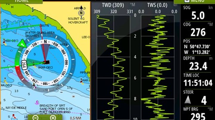
SailingTime
Plan effectief met SailingTime en weet hoelang het duurt om een waypoint te bereiken, zelfs als het tegen de wind in is. SailingTime berekent de tijd die u aan elke koers besteedt, waarbij rekening wordt gehouden met wind- en getijde-effecten, zodat u een nauwkeurige ETA op uw bestemming krijgt.
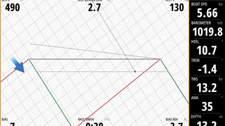
RacePanel
Wees met RacePanel op de lijn wanneer het startschot klinkt. Dankzij de gebruiksvriendelijke functies die eerder alleen door professionele navigators werden gebruikt, kunt u het beste beginnen in uw vloot, met informatie over tijd, afstand en positionering op één helder display.
Belangrijkste kenmerken
- Uitstekende schermweergave, met ultrabrede kijkhoeken
- Gemakkelijk te bedienen, ook in natte omstandigheden of bij zwaar weer op zee
- Krachtige processor zorgt dat alles soepel werkt en de kaartweergave snel wordt aangepast
- Speciale zeilfuncties, zoals SailSteer, Laylines en RacePanel
- Ingebouwde Wi-Fi biedt snel toegang tot kaarten, weersinformatie, updates en support, plus schermdeling
- Ingebouwde ForwardScan™ sonar-ondersteuning om veiliger door ondiep water te varen
- Naadloze integratie met andere B&G-schermen en -accessoires in een totaalsysteem voor de hele boot
- Verkrijgbaar in de schermformaten 7, 9, 12 en 16 inch (nieuw)
Specificaties
- Display
- Displayresolutie
- 600 x 1024
- Kijkhoeken
- 80° top/bottom, 80° left/right
- Kleur achtergrondverlichting
- White
- Schermgrootte
- 7 inches
- Connectiviteit
- Aan te sluiten op NMEA 2000
- 1 x NMEA 2000 Micro-C port, 1 LEN
- Aan te sluiten op pc
- No
- Bluetooth
- Internal
- Ethernetpoorten
- 1 x 5 pin yellow connector x 10/100 Mbit
- Gegevensopslag SD-kaart
- 2 Micro SD slots, max. 32GB each. Larger if formatted to NTFS
- item beschikt over Wi Fi verbinding
- Internal
- N2K-PGN's
- Receive only59392 ISO Acknowledgement59904 ISO Request60160 ISO Transport Protocol, Data Transfer60416 ISO Transport Protocol, Connection M.65240 ISO Commanded Address60928 ISO Address Claim126208 ISO Command Group Function126992 System Time126996 Product Info126998 Configuration Information127233 Man Overboard Notification (MOB)127237 Heading/Track Control127245 Rudder127250 Vessel Heading127251 Rate of Turn127252 Heave127257 Attitude127258 Magnetic Variation127488 Engine Parameters, Rapid Update127489 Engine Parameters, Dynamic127493 Transmission Parameters, Dynamic127500 Load Controller Connection State / Control127501 Binary Status Report127503 AC input status127504 AC Output Status127505 Fluid Level127506 DC Detailed Status127507 Charger Status127508 Battery Status127509 Inverter Status128259 Speed, Water referenced128267 Water Depth128275 Distance Log129025 Position, Rapid Update129026 COG & SOG, Rapid Update129029 GNSS Position Data129033 Time & Date129038 AIS Class A Position Report129039 AIS Class B Position Report129040 AIS Class B Extended Position Report129041 AIS aids to Navigation129283 Cross Track Error129284 Navigation Data129539 GNSS DOPs129540 AIS Class B Extended Position Report129545 GNSS RAIM Output129549 DGNSS Corrections129551 GNSS Differential Correction Receiver Signal129793 AIS UTC and Date Report129794 AIS aids to Navigation129798 AIS SAR Aircraft Position Report129801 Cross Track Error129802 AIS Safety Related Broadcast Message129283 Cross Track Error129284 Navigation Data129539 GNSS DOPs129540 GNSS Sats in View129794 AIS Class A Static and Voyage Related Data129801 AIS Addressed Safety Related Message129802 AIS Safety Related Broadcast Message129808 DSC Call Information129809 AIS Class B “CS” Static Data Report, Part A129810 AIS Class B “CS” Static Data Report, Part B130060 Label130074 Route and WP Service - WP List - WP Name & Position130306 Wind Data130310 Environmental Parameters130311 Environmental Parameters130312 Temperature130313 Humidity130314 Actual Pressure130316 Temperature, Extended Range130569 Entertainment - Current File and Status130570 Entertainment - Library Data File130571 Entertainment - Library Data Group130572 Entertainment - Library Data Search130573 Entertainment - Supported Source Data130574 Entertainment - Supported Zone Data130576 Small Craft Status130577 Direction Data130578 Vessel Speed Components130579 Entertainment - System Configuration Status130580 Entertainment - System Configuration Status130581 Entertainment - Zone Configuration Status130582 Entertainment - Zone Volume Status130583 Entertainment - Available Audio EQ Presets130584 Entertainment - Bluetooth Devices130585 Entertainment - Bluetooth Source StatusTransmit60160 ISO Transport Protocol, Data Transfer60416 ISO Transport Protocol, Connection M.126208 ISO Command Group Function126992 System Time126993 Heartbeat126996 Product Info127237 Heading/Track Control127250 Vessel Heading127258 Magnetic Variation127502 Switch Bank Control128259 Speed, Water referenced128267 Water Depth128275 Distance Log129025 Position, Rapid Update129026 COG & SOG, Rapid Update129029 GNSS Position Data129283 Cross Track Error129285 Navigation - Route/WP Information129284 Navigation Data129285 Route/Waypoint Data129539 GNSS DOPs129540 GNSS Sats in View130074 Route and WP Service - WP List - WP Name & Position130306 Wind Data130310 Environmental Parameters130311 Environmental Parameters130312 Temperature130577 Direction Data130578 Vessel Speed Components
- Ondersteuning voor NMEA 0183-sentences
- Input: GGA, GLL, GSA, GSV, VTG, ZDA, RMC, DBT, DPT, MTW, VLW, VHW, HDG, HDT, HDM, MWV, MWD, DSC, DSE, VDM. (Note AIS sentences are not bridged to or from NMEA 2000)Output: GGA, GLL, GSA, GSV, VTG, ZDA, RMC, DBT, DPT, MTW, VLW, VHW, HDG, MWV, MWD, TLL, TTM
- Video
- 2 x composite (RCA connectors)video inputs. Optional video/ data cable required (P/N 000-00129-001).
- automatische piloot
- Manoeuvres/wendpatronen
- U-turn, Spiral-turn, C-turn, Zig-zag, Square-turn, Lazy S-turn, Depth contour tracking
- Stuurstanden
- Auto, Nav., No Drift, Follow up, Non-follow up, Turn patterns, Standby, *Wind, *Wind NAV. (*Boat type set to Sail)
- Goedkeuringen
- Naleving van goedkeuringen
- CE, C-Tick, HDMI, EN 60950-1:2006, EN 60945:2002 EN 300 440-2, V1.4.2
- Elektrisch
- Aanbevolen stroomsterkte zekering
- 3A
- Max. stroomverbruik
- 20 W
- Voedingsspanning
- 10 - 31.2 V DC
- Omgeving
- Bedrijfstemperatuurbereik
- -15°C to +55°C (5° F to 131° F)
- Opslagtemperatuurbereik
- -20°C to +60°C (4°F to 140°F)
- Waterbestendigheid
- IPX6 and 7
- GPS
- Correctie
- WASS, MSAS, EGNOS, GLONASS
- GPS-ontvangstkanalen
- 34 Channels
- Positienauwkeurigheid
- Horizontal Accuracy 3 m (9.8 ft)
- Tijd tot eerste positiebepaling
- Cold start 50 sec, Satellite Reacquisition 5 sec
- Updatesnelheid
- 10 Hz
- MFD
- AIS
- Receive AIS data over NMEA 2000 or *NMEA 0183 (*NMEA 0183 has to be wired to all NSS processors)
- Digital switching
- C-Zone, Naviop
- Geschikt voor sonar
- Two 9 pin Xsonic Sonar ports. Sonar port 1: Single channel CHIRP, 50/200 kHz, HDI. Sonar port 2: Single channel CHIRP, 50/200 kHz, Active Imaging, TotalScan, LSS HD, ForwardScan. Compatible with: S5100, SonarHub, BSM-3, BSM-2, network echo sounders
- GPS
- Internal
- Inclusief cartografie
- World basemap (no detailed charts)
- Interne opslag
- 16 GB
- Multimedia
- via SonicHub2, FusionLink, *Sirius, **JL Audio. *USA only, **AUST. & NZ only)
- Stuurautomaat
- Full auto pilot control and commissioning
- Waypoints, routes, tracks
- 6000 waypoints, 500 Routes with 100 max route points, 50 tracks with up to 12,000 track points.
- Weer
- SiriusXM via WM-4 / WM-3 (USA only), GRIB
- Fysiek
- Afmetingen (H×B×D)
- 239 x 150 x 90 mm (9.4 x 5.9 x 3.5")With bracket: 263 x 161 x 93 (10.35 x 6.31 x 3.66)
- Gewicht
- 1.1 kg (2.42 lbs.)
- Type montage
- Bracket (Supplied) or panel mount
- Ander
- Garantieperiode
- 2 Years
- Interface
- Full touch screen (multi-touch ) and full keypad control, ZC2 remote controllers
- Talen
- Standard Language Pack: English(US), English(UK), Danish, German, Spanish, Finnish, French, Greek, Icelandic, Italian, Dutch, Norwegian, Portuguese, SwedishOther languages supported by Unlock:Japanese, Korean, Thai, Chinese, Bulgarian, Hebrew, Croatian, Hungarian, Lithuanian, Latvian, Polish, Slovak, Turkish, Russian, Ukrainian, Arabic, Farsi
